Last Update: 20 Jul 2008
|
|
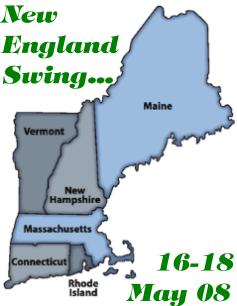
Yeah, gas was already up to $ #@%&! a gallon, but we had already scheduled ourselves to be in Boston well before that happened. Since we didn't know when we'd get the opportunity for Kieran and Thalia to add to the list of states in which they'd set foot, we turned our trip into a New England Swing-- all six states in under three days! And we have the signs to prove it...
| Last Update: 20 Jul 2008 |
|
| 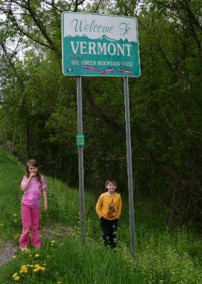
First up: Vermont! Kieran had been here before-- before he could walk, actually-- but Thalia had not. As a bonus, we took the road that my parents took for our first setting foot in the Green Mountain State as well-- that would be NY Route 7, which becomes Vermont Route 9, er, right about there in the photo, actually!
| |
|
| 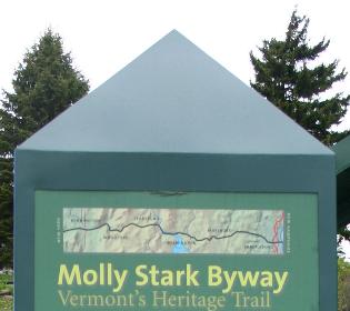
Route 9 is now called the Molly Stark Byway, as evidenced by the segment of the marker at left. "[T]he worst road I ever traveled, through mire and ruts..." complained one traveler. Fortunately, that was in 1777. The road is a lot better now.
| At right is the sign for the Skyline Restaurant at the top of Hogback Mountain. "Famous waffles and griddle cakes with pure Vermont Maple Syrup"! Yum! During my first trip to Vermont we ate here. We were told that it's been closed for some time now but hopefully will reopen soon. 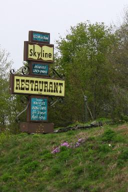
|
|
| 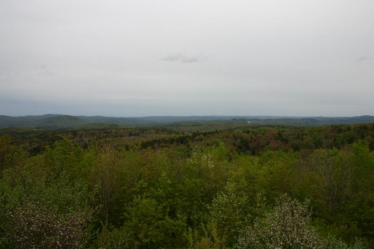
A view looking south from our vantage point atop Hogback Mountain. Pretty despite the overcast...
| |
|
| 

|
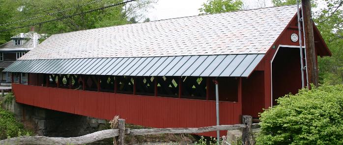
| Vermont law requires that every tourist take at least one image of a covered bridge. OK, maybe not, but here's ours, specifically the Creamery Bridge in Brattleboro, still along Route 9. It's circa 1879 per the sign posted on it, but I think the pedestrian passageway (foreground, with the metal roof) might date from a bit later than that. We also met the requirement for posing the kids on the bridge... well, maybe that's not obligatory either, but so what? |
|
| 
On to New Hampshire! This state was new for Thalia, though Kieran was here very briefly one night several years before, and didn't see more than a shopping center. That almost doesn't count-- along the southeastern border of the state, there's no real distinguishing it from Massachusetts. Well, except for the general sales tax and income tax...
| If you're following along, we stayed on Vermont Route 9 until Interstate 91, which we took for one exit to bypass the center of Brattleboro, then rejoined Route 9 north of town. Crossing the Connecticut River into New Hampshire, the number nine stays with the route. We passed through Keene, moving over to NH Route 101, bought some gas and snacks, and then it was non-stop on to... |
|
| 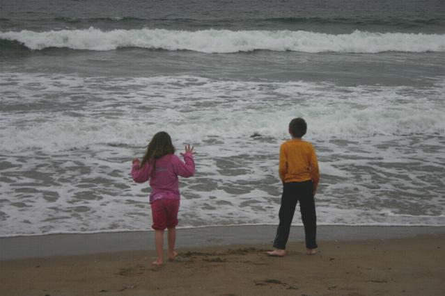
...the ocean! Specifically, Hampton Beach, and the kids' first view of the Atlantic in a couple of years. Considering that Rosemary and I are a bi-coastal couple (she's from California and I'm from New Jersey), I suppose it's not surprising that Kieran and Thalia have waded in the Pacific Ocean more than the Atlantic. Not like I'm keeping score... although add one to the Atlantic tally...
| |
|
| 
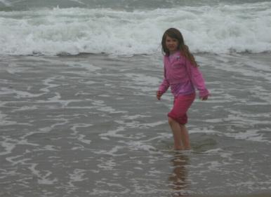
And I do mean waded, even though, by my estimation, the water was pretty cold!
| |
|
| 
|
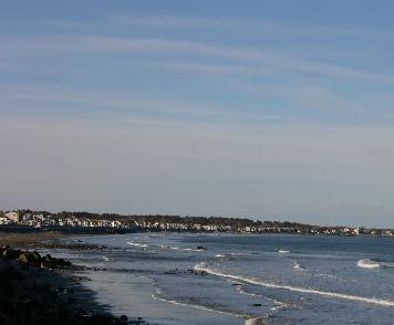
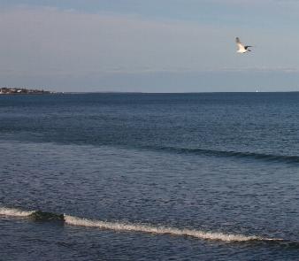
| It was a cloudy day and it was getting quite late by the time we got to Hampton Beach, so through some convenient time travel to a previous solo trip I made, here are a few more shots of the New Hampshire Seacoast. Route 1A is highly recommended from Hampton Beach north to Portsmouth as a scenic journey. | 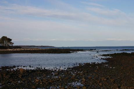
|
|
| 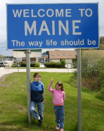
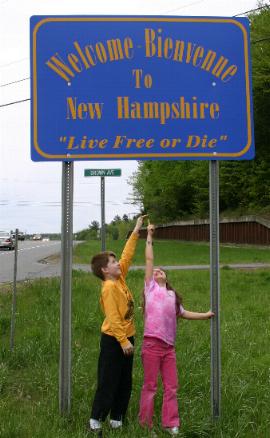
On to Maine! We actually did set foot there late the previous evening, but returned in the morning to take the official sign photo in Kittery and do some shopping. (Note new shoes on both Kieran and Thalia...) It was the first visit to "Vacationland" for both kids and possibly for Rosemary as well (we can't verify that).
| Later that day, we happened to sit next to a couple from Kittery who remarked that they've seen people taking photos with this sign hundreds of times! |
|
| 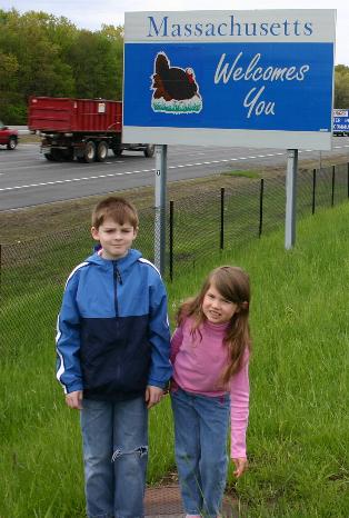
And then it was quickly down Interstate 95 back through New Hampshire to Massachusetts. I was wondering how I was going to get this sign; fortunately there was one right at the rest stop and welcome center on I-95. This was a return visit to the Bay State for both Kieran and Thalia. I suspect Kieran was getting a little weary of these Official State Recordings...
| |
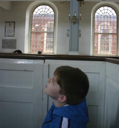
| After arriving in Boston, we had lunch at the Faneuil Hall Marketplace and then it was off on the Freedom Trail. Here, Kieran contemplates part of Old North Church. Only 25 years previously, I was there on my first visit to the city; and I might have sat in the same place.
| 
|
|
| 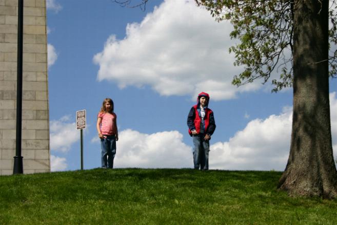
"Hey, Dad, we're at the Bunker Hill Monument! Let's climb to the top!"
| |
|
| 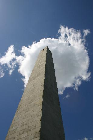
"But it's 294 steps to the top!"
| "We should do it! It'll be great!" "Come on, Dad, let's go!" "Are you sure?!?" |
| Uh, yeah, they were sure...
| 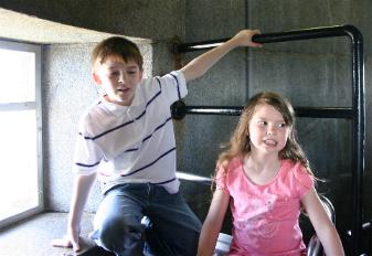
...interestingly, back on the ground, I had heard someone say "My legs feel like rubber." I knew what they meant. The way down is unexpectedly challenging, by the way, and perhaps more "rubberizing" than the way up.
| |
|
| 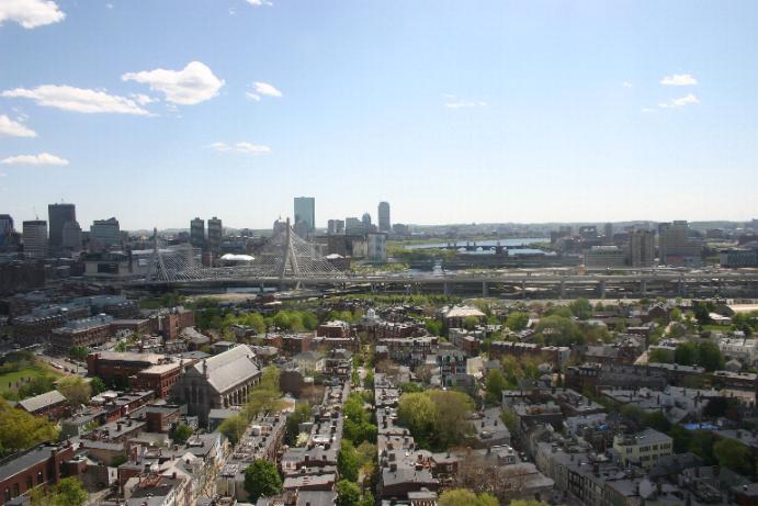
But there is no question that the view, on what turned out to be a spectacular day, was well worth the effort!
| That's the Leonard Zakim Bunker Hill Bridge middle distance of the photo, modern yet with towers modeled after the Bunker Hill Monument itself-- a beautiful addition to the skyline of the city. It's the widest cable-stayed bridge in the world. Look up the story of Lenny Zakim for yourself; I think you will be touched. |
| With Kieran in the background, Thalia points to the actual reason and purpose for our trip. Keiko Matsui is a talented and accomplished pianist who, while nominally placed in the "smooth jazz" category, transcends definitions with her beautiful music. She is Kieran's favorite artist.
| We sat in the very front row of the jazz club where Keiko and her band performed, and the show was everything we'd hoped for and more. After the show Kieran and I met her and had a CD autographed. She took the time to greet everyone who stayed to say hello. If you're reading this, Keiko, thank you for "Forever, Forever." 
|
|
| 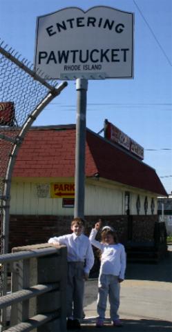
The agenda for the next day was largely Head For Home. But there were still two states in which the kids needed to set foot to complete the New England Swing. The first of these was Rhode Island, new for both Kieran and Thalia. Again if you're following along, we left Boston on the Mass Pike (Interstate 90) to Route 128/I-95, then over to I-295. From there we exited onto US Route 1-- a bit too early, actually. The sign in the photo made it official, but it wasn't quite what I wanted-- even if the bridge on which I am standing crosses a railroad (Amtrak's Northeast Corridor, formerly the New Haven).
| |
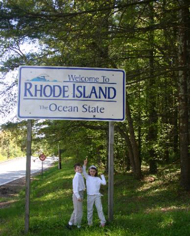
| This sign, along US Route 44, is a lot more like it! Route 44 is quite scenic through Western Rhode Island. Before getting to it, we breezed through Providence including a look at the capital from I-95, then backtracked via Route 10, US 6 and I-295.
| 
|
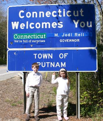
And we wrap up the official coverage of the New England Swing on the other side of the road from the Rhode Island sign. We know that Kieran had been to Connecticut, but we weren't sure about Thalia, so just to make it complete, we ensured that they set foot.
| From this point, we ambled through the eastern part of the Nutmeg State via US 44, State 74, and Interstate 84 to Hartford. After lunch and a stop for coffee beans (really!) it was back home from Hartford... non-stop! |